Our expertise extends across various domains, including GIS mapping applications, spatial data visualization, and GIS project management, ensuring that we provide innovative and effective solutions for every project.

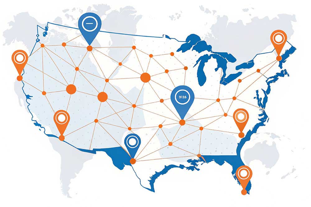
Picture multiple datasets like roadways, land usage,and demographics.
Consists of size devices, advanced searchoptions, and custom filters.
Incorporates GeoJSON, KML, Shapefile, CSV or API-based data for real-time updates.
Visualize density designs for smarter selections.
Highlight local varieties, like flood dangers.
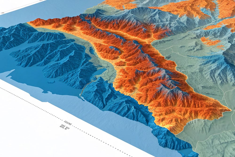
Add depth to your geospatial information for boosted analysis.
Perform buffer analysis, overlays, and also spatial joins.
Convert addresses to coordinates and vice versa.
Gain insights into elevation, slope,and element utilizing DEMs.
Improve metropolitan mobility and logistics operations
Track motor vehicles and properties in real-time for smarter information monitoring.
Boost property decision-making with geospatial intelligence.
Optimize zoning, land usage, and infrastructure development.
Enhance plant control and irrigation planning
Support farming and also replenishable energy tasks with updated weather records.
Seamlessly change GeoJSON, KML, Shapefiles, and CSV layouts.
Leverage platforms like PostGIS for central database monitoring.
Enable effective teamwork with centralized GIS systems
Monitor and defend biodiversity along with accurate resources.
Address urban challenges with noise and pollution mapping.
Plan proactively with enhanced hydrology GIS devices.
Transform paper maps, aerial imagery, or scanned maps into editable, digital formats.
Design and develop digital maps tailored to specific needs, such as topographic, thematic, or interactive maps.
Integrate various data layers, such as roads, landmarks, and terrain, to enhance the map’s usability for decision-making and analysis.

An effective performance history in providing advanced GIS solutions.

Cutting-edge modern technologies like PostGIS, Django, and Folium.

End-to-end support, from advancement to execution.

Customized GIS resources that line up easily with your object
Companion with vNode Digital for geospatial solutions that empower development and success. Whether you need to have an involved GIS application, advanced analytics, or real-time tracking, our company has the know-how to provide.
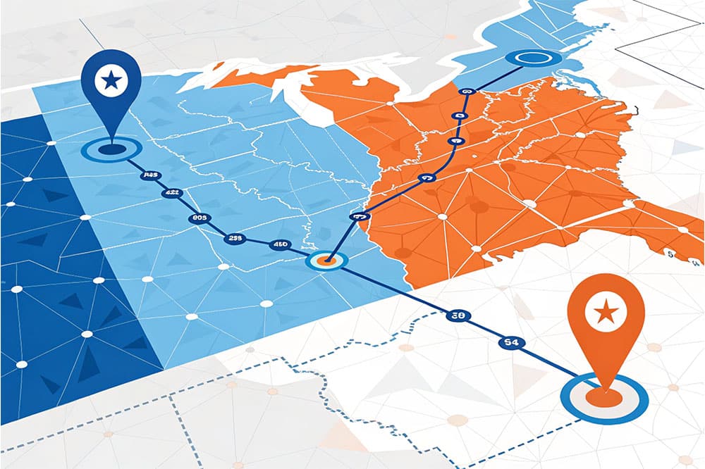
Dynamic information layers combine multiple datasets, such as roadways, land usage, and demographics, into a unified system for analysis and visualization. These layers enable dynamic mapping and decision-making by integrating spatial and non-spatial data, often in real-time. They are widely used in urban planning, environmental monitoring, and resource management.
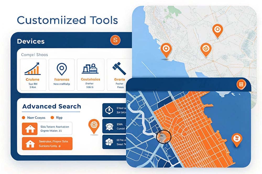
Customized tools provide bespoke functionalities like size adjustments, advanced search capabilities, and personalized filters to amplify user experience. These solutions ensure precise data sorting, seamless organization, and customized results for applications such as eCommerce, content management, and database searches.

Data integration enables the seamless incorporation of diverse geographic data formats, such as GeoJSON, KML, Shapefile, CSV, or API-based sources, to support real-time updates. This ensures efficient data management and compatibility for geospatial applications.

Heatmaps are graphical tools that use color gradients to represent data density or intensity, making it easier to identify patterns, trends, and anomalies in large datasets. They simplify complex data visualization by mapping values to colors, offering intuitive insights for decision-making across fields like web design, marketing, and scientific research.
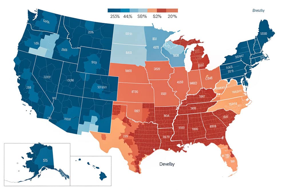
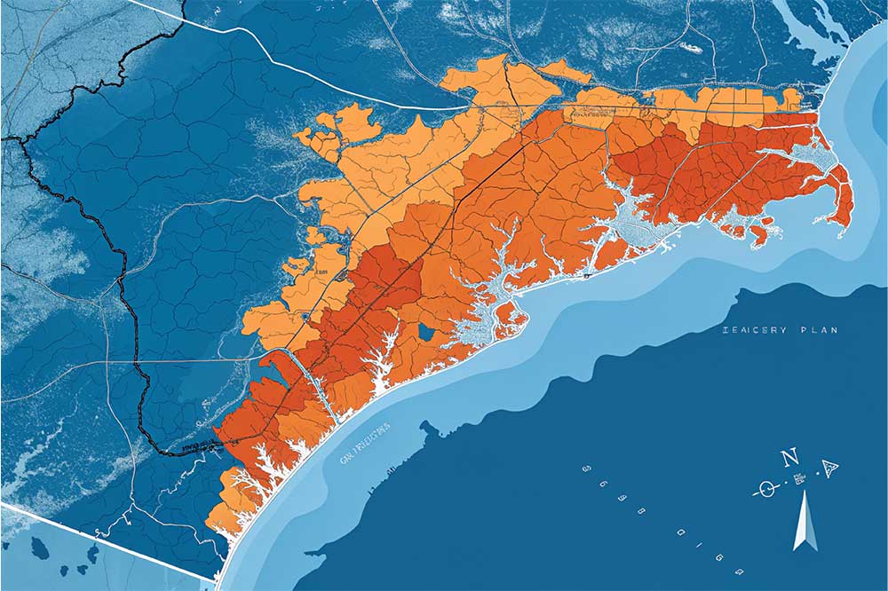
A choropleth map is a thematic map that uses shading, coloring, or patterns to represent data values across predefined geographic areas. It effectively highlights spatial variations and patterns, such as flood risks or population density, by assigning colors proportional to the data values in each region.

3D visualization enhances geospatial analysis by adding depth and realism, enabling better understanding of spatial relationships and patterns. It supports dynamic perspectives, interactive exploration, and realistic simulations for applications like urban planning, disaster management, and environmental monitoring.

Spatial analysis involves using advanced techniques to examine geographic data, uncovering patterns, relationships, and insights. It includes operations like buffer analysis, overlays, and spatial joins to assess proximity, intersections, and attribute relationships in geospatial data. These methods are widely applied in fields like urban planning, public health, and environmental studies.

Geocoding services convert text-based location descriptions (e.g., addresses or place names) into geographic coordinates (latitude and longitude) and vice versa. This process supports mapping, spatial analysis, and data visualization, enabling users to locate and analyze geographic features on maps.
Leverage GIS tools to analyze terrain features such as elevation, slope, and aspect using Digital Elevation Models (DEMs). This enables precise landscape evaluation for environmental studies, urban planning, and natural resource management.
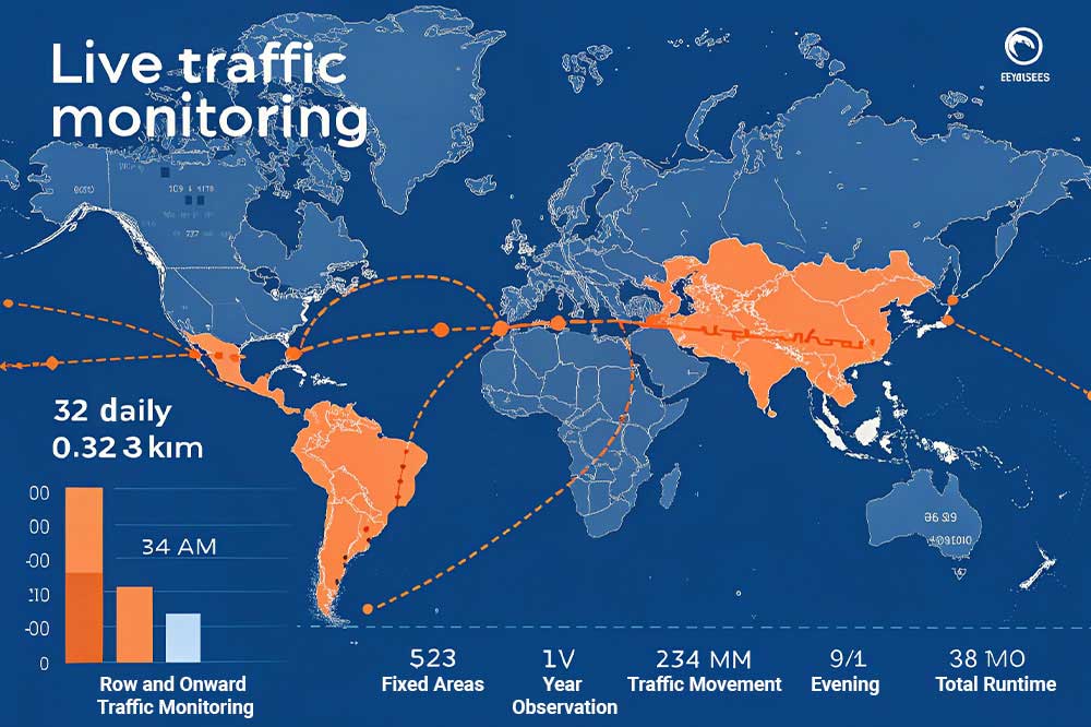
Leverage GIS-based live traffic monitoring to enhance urban mobility and streamline logistics. By integrating real-time data from sensors, cameras, and GPS devices, this solution provides actionable insights for traffic flow optimization, incident management, and route planning. It ensures safer roads, reduces congestion, and improves operational efficiency for transportation and logistics.
IoT Tracking integrates GIS technology to enable real-time tracking of motor vehicles and properties. It provides smarter information monitoring, enhancing operational efficiency and decision-making through location-based insights.

Geospatial intelligence in real estate enhances decision-making by integrating spatial data for property valuation, market analysis, risk assessment, and strategic planning. It enables better site selection, compliance with zoning laws, and predictive analytics for future trends. This technology improves marketing, client engagement, and operational efficiency while supporting informed investments and sustainable development.
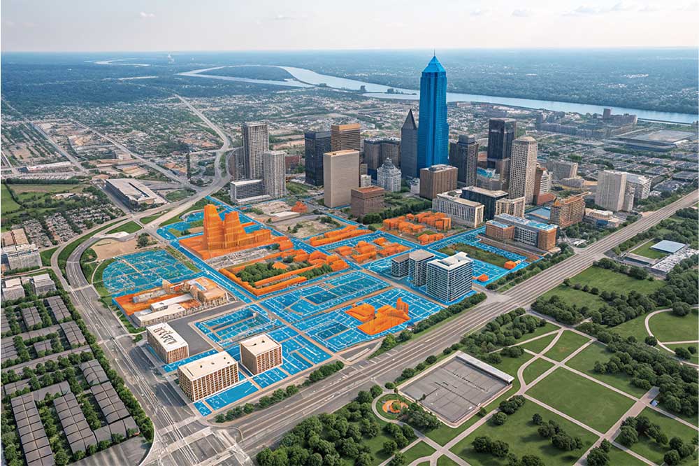
Geographic Information Systems (GIS) strengthen urban planning by analyzing spatial data to optimize zoning, land use, and infrastructure development. GIS allows planners to make informed decisions, improve resource allocation, and create sustainable urban environments.
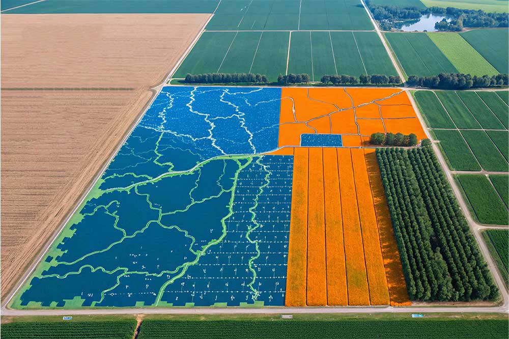
GIS (Geographic Information Systems) revolutionizes agriculture by integrating spatial data and advanced analytics to optimize farming practices. It enhances irrigation planning, crop health monitoring, and resource management, enabling precise water and fertilizer use. By leveraging satellite imagery, remote sensing, and soil data, GIS supports sustainable farming, boosts yields, and minimizes environmental impact.
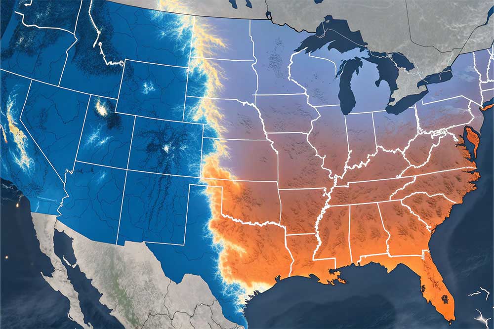
Enhance decision-making in farming and renewable energy projects with real-time weather data. This GIS solution provides accurate, updated weather records for improved planning and resource management.

Data Conversion refers to the seamless transformation of geospatial data formats such as GeoJSON, KML, Shapefiles, and CSV. This process ensures compatibility across platforms and applications, enabling efficient use of geographic data for analysis, visualization, and integration.
Database integration involves leveraging platforms like PostGIS to monitor and manage spatial data within a centralized database. PostGIS extends PostgreSQL with advanced geospatial capabilities, enabling efficient storage, querying, and analysis of spatial data. This integration enhances GIS applications by supporting real-time updates, spatial indexing, and complex geospatial operations.

Multi-team collaboration in GIS leverages centralized systems to enable effective teamwork by integrating spatial data and tools. It enhances communication, decision-making, and productivity across diverse teams, ensuring seamless workflows and real-time updates. This approach is vital for projects requiring input from various disciplines, such as urban planning, disaster management, and environmental studies.
The Wildlife Tracking GIS system enables precise monitoring and protection of biodiversity. By leveraging geospatial data, it tracks wildlife movements, identifies critical habitats, and supports conservation efforts with actionable insights.
Air quality monitoring and noise pollution mapping using GIS technologies enable urban planners to address environmental challenges effectively. GIS integrates spatial data with real-time monitoring, helping to identify pollution hotspots, create actionable maps, and support decision-making for healthier urban environments.
Flood Risk Assessment helps identify, evaluate, and mitigate potential flood hazards using advanced hydrology GIS tools. It enables proactive planning to safeguard communities, infrastructure, and ecosystems from flood risks by analyzing terrain, rainfall patterns, and water flow dynamics.

Map digitization converts physical maps, aerial imagery, or scanned documents into precise, editable digital formats. This process enhances accessibility, accuracy, and integration with GIS tools for analysis and visualization.

Create and design digital maps customized to specific requirements, including topographic, thematic, or interactive maps. Ideal for businesses, researchers, and organizations seeking precise geographic visualization and analysis.

Enhance decision-making and spatial analysis with GIS data layer integration. Combine roads, landmarks, terrain, and other datasets into a unified map for comprehensive insights. Ideal for urban planning, disaster management, and resource allocation.
